 LO
LO
Get told when a verified record lands on this occupation → · Mark which of these tasks are yours (VOLO Pro, free during the launch) →
Land surveyor
Measures land and buildings, works out where legal boundaries lie, sets out construction on site and certifies survey plans. Measurement is changing fastest: Britain's mapping agency flies drones that cover in 20 minutes sites a field surveyor would take a day to survey, and Japan now allows aerial and remote-sensing methods for official cadastral surveys of farmland. On Japan's national earthworks, machine guidance from 3D designs has largely replaced setting out with survey stakes. Deciding where a boundary lies stays with people: New Zealand's rules require the surveyor to gather and interpret the evidence and to certify the survey personally, and Japan's boundaries still rest on owners' confirmation. The US projects surveyor jobs to grow 6 percent to 2035, saying surveyors will still be needed to review and interpret what drones produce.
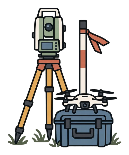
Find out what licence your country requires to fly survey drones commercially and what it costs.
This is not a probability of losing your job. It combines how much of the role's task load is exposed to automation with how far adoption has actually gone — useful for comparing occupations on one consistent basis, and for nothing else.
Written for land surveyors and survey technicians who measure, set out and certify, in private practice, construction and public agencies. Quantity surveyors and GIS analysts have their own pages. The evidence is a US labour projection, New Zealand's cadastral survey rules, Japanese government rule changes and reports on aerial cadastral surveys and machine-guided earthworks, a study of drone mapping against cadastral accuracy, and Britain's mapping agency on its drone team; it establishes where measurement and setting out are changing and who still decides and signs, not how surveyors' numbers or pay have changed.
What is actually changing#
The unit of analysis is the task, not the job title. A role is not replaced — its task mix shifts.
Each tile is one task. Its size is how much of the job it is; its colour is where the task is heading. Click a tile to see what the judgement does not establish.
One agency's account and one study in one country; they do not show how many surveyors' field hours have changed.
Rules in two countries; they govern who decides, not how long the research takes or whether software helps with it.
One country's public earthworks; time savings come from contractors' own estimates, and small works still use conventional methods.
A projection's explanation; it does not measure how much processing is automated today.
One country's rule; it does not show how much of a surveyor's time certification takes.
Is this your job? Say so and this page narrows to your share of it.
A job title is a bundle of tasks bought together, and no two people hold the same bundle. Nothing is sent anywhere — it stays in this browser.
Read all 5 tasks in full — direction, reasoning and limits →
Recent changes#
United States. The statistics bureau projects surveyor employment to grow 6 percent from 2025 to 2035, from 52,000 to 55,000. It says that although drones and other advancements make some aspects of survey work more efficient, surveyors will continue to be needed to review and interpret the output of these technologies to ensure accuracy and completeness.
A named person with standing publicly predicted something, on a date, in an attributable statement. It is recorded so that who said what, and when, stays checkable — and it never moves a task's assessment, because a prediction is not an observation. Its value arrives later: the record sits on the same page as the evidence about that occupation, so anyone reading the forecast reads the record of what happened next beside it. That is the reckoning; this site publishes no verdict on whether a forecast came true.
Japan. The ministry's status report says that from fiscal 2025 ICT construction became the default for earthworks and dredging, used on more than 90 percent of tenders for its directly managed civil works, cutting working time on ICT earthworks by about 30 percent; among its effects it lists fewer survey stakes, with machines guided by 3D design data. The time savings are averages from a contractor survey against contractors' estimates of conventional work; small works still face barriers.
An employer has put it into production. Can move the baseline — weighted by scale and how similar the setting is.
Japan. The ministry announced an amendment, promulgated and in force from 28 June 2024, extending the area where cadastral surveys may use aerial and remote-sensing methods from forest and wild land to farmland and its surroundings, citing advances in surveying technology. It also introduces deemed confirmation: where owners do not respond within 20 days to a proposed boundary, the survey may proceed as if they had confirmed it. Measurement changes; the boundary still rests on owners' confirmation.
An employer has put it into production. Can move the baseline — weighted by scale and how similar the setting is.
Great Britain. The national mapping agency says its drone pilots complement over 200 surveyors and two planes in capturing landscape features; the drone team flew 1,300 flights in 2023, and an average flight of 20 minutes can survey sites that would normally take a field surveyor a whole day, working best on new and larger sites such as housing estates, wind and solar farms. The agency's own account; it gives no figures on surveyor numbers over time.
An employer has put it into production. Can move the baseline — weighted by scale and how similar the setting is.
New Zealand. The rules require a surveyor to gather all evidence relevant to the definition of a boundary and its boundary points, interpret that evidence in accordance with all relevant enactments and rules of law, and use it to determine the correct position of the boundary; a licensed cadastral surveyor must certify that the survey was undertaken by them or under their personal direction. A rule on who decides and signs; it does not say how measurements are taken.
Failure, rollback, regulation or cost is suppressing adoption. Can lower an assessment or widen its uncertainty.
Czech Republic. Over twelve test areas, drone photogrammetry and laser scanning were checked against control points measured with RTK-GNSS and total stations. The required cadastral accuracy of 0.14 m was achieved on more than 80 percent of points from image point clouds and orthoimages and 98 percent from the laser point cloud, but the surveys lacked completeness, which must be supplied by geodetic measurements. A study of capability; it does not describe how cadastral offices work.
A demo, benchmark or paper shows the task can be done. Updates what the technology can do — not what employers will do.
What this means for you#
If you are starting out, expect drones, scanners and machine guidance to do more of the measuring and marking. Build what they do not do: boundary research and judgement, checking what the instruments produce, and the licence that lets you sign.
Expect fewer days in the field per job and less hand setting out on large earthworks. Boundary work, checking and signing stay with you.
Your options#
Four directions, each with its real constraints and one thing you can test this week. Continuing as you are is a legitimate choice — it just has to be a chosen one.

Add drone and scanning work to your practice
Mapping agencies and contractors are moving measurement to drones and scanners, which still need a surveyor to plan, check and interpret.
Drone work needs a pilot licence and equipment, and drone data does not cover everything on its own.
Find out what licence your country requires to fly survey drones commercially and what it costs.
Move towards boundary and cadastral work
Rules require a licensed surveyor to gather and interpret boundary evidence and to certify surveys personally.
Cadastral work needs a licence and knowledge of land law, which takes years to build.
Look up what your local licensing board requires to certify boundary surveys.
Look at 3D design data and machine guidance
Where machines are guided by 3D design data, someone has to prepare, check and maintain that data on site.
It is closer to construction engineering and may mean working for contractors rather than in a survey practice.
Ask the contractors you work with whether they use machine guidance and who prepares the 3D data.
Common questions#
Not on present evidence. Drones and machine guidance take over part of the measuring and setting out, but rules keep boundary decisions and certification with licensed surveyors, and the US projects surveyor jobs to grow 6 percent from 2025 to 2035.
We do not answer that with a number of years. Watch whether rules on who may determine and certify boundaries change, and how much setting out on your projects moves to machine guidance. Those tell you more than any date.
In a Czech study, drone photogrammetry met the 0.14 m cadastral accuracy on more than 80 percent of points and drone laser scanning on 98 percent, but the surveys were incomplete and had to be supplemented by conventional measurement.
No. A drone measures; deciding where the legal boundary lies means weighing deeds, plans and marks under the law, which New Zealand's rules assign to the surveyor, and in Japan the owners still confirm the boundary.
What these judgements rest on#
4 of 5 task judgements on this page are backed by a verified event and 1 are platform inference, each labelled where it appears. Behind them sit 2 technology dimensions, a reconstructed trajectory since language models reached the public, and 6 verified events.
See which technologies, how it got here, and the method →
Where it sits in the official classification: skills, knowledge, related jobs →
Other roles in the same function#
A company divides its work into functions before it divides it into jobs. These sit in Core delivery (industry-specific) alongside this one — a fact about org charts, not a judgement that they are similar or that they are changing in the same direction.
Content moderator · Registered nurse · Radiologist · Pathologist · Radiographer / radiologic technologist · General practitioner / primary care doctor · Surgeon · Anaesthesiologist / anaesthetist · Optometrist · Care worker / nursing assistant · Counsellor / psychotherapist · Psychologist · Dietitian / nutritionist · Pharmacist · Pharmacy technician · School teacher · Driving instructor · University lecturer · Chef / cook · Electrician · Plumber · HVAC technician · Architect · Drafter / CAD technician · Interior designer · Civil / structural engineer · Urban planner · GIS analyst / cartographer · Electrical engineer · Chip design engineer · Mechanical engineer · Industrial engineer · Quantity surveyor · Journalist · Editor and proofreader · Translator / Interpreter · Interpreter · Retail cashier / shop assistant · Bank teller · Medical assistant / clinic assistant · Waiter / restaurant server · Bartender / barista · Hairdresser / barber · Construction worker · Bricklayer / blocklayer · Carpenter / joiner · Auto mechanic / vehicle technician · Medical laboratory technician · Physiotherapist / rehabilitation therapist · Massage therapist · Firefighter · Paramedic / EMT · Police officer · Farmer · Gardener / landscaper · Social worker · Dentist · Dental hygienist · Veterinarian · Librarian · Welder · Sonographer